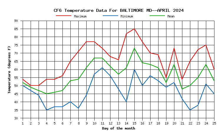
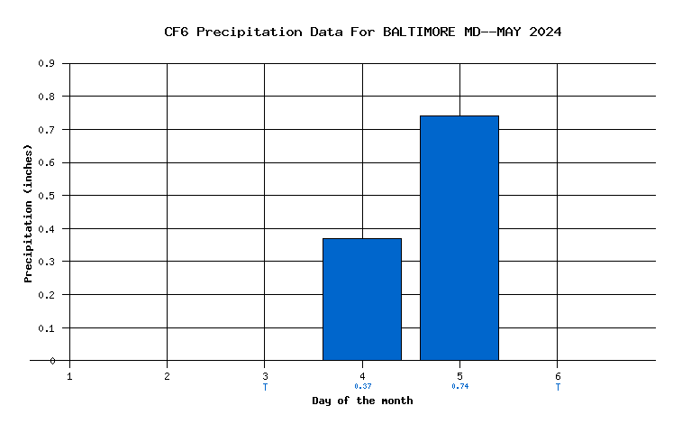
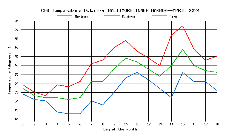
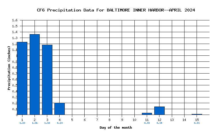
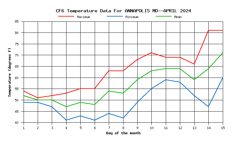
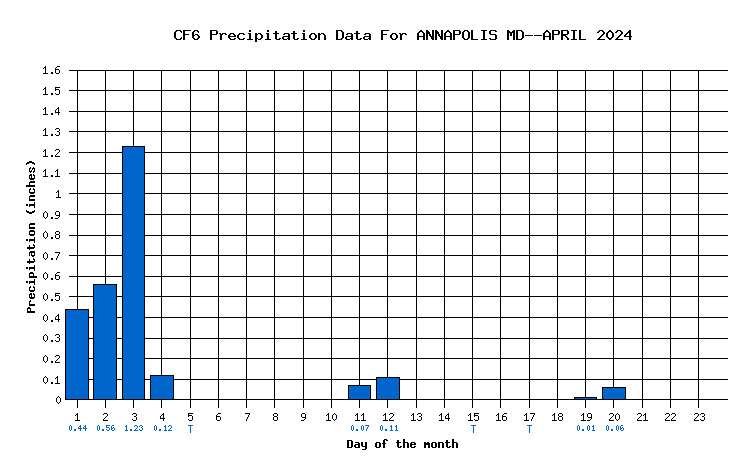
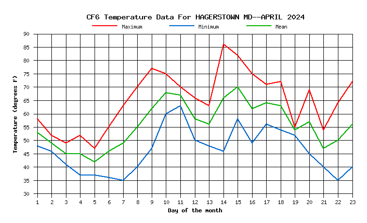
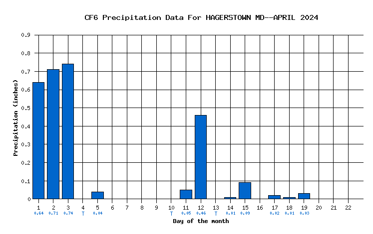
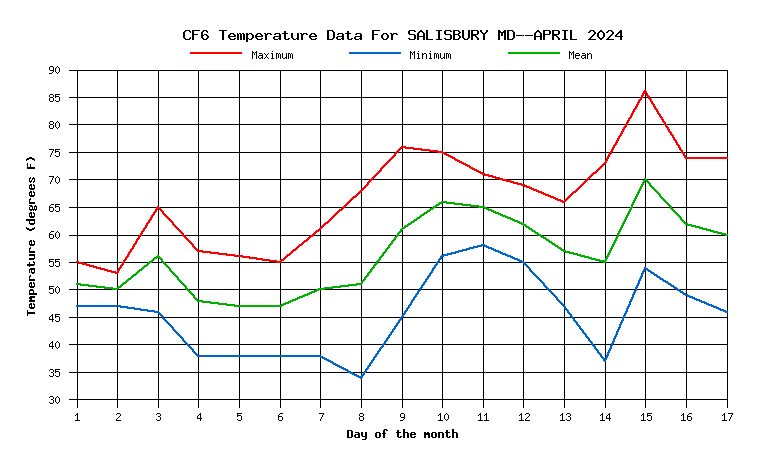
I wrote a script that generates temperature and precipitation graphic charts based on the F-6 data retrieved from the National Weather Service via FTP. The tools I used include ActivePerl and Ploticus. On the temperature graphs, maximum temperature is plotted in red, the minimum in blue, and the average in green. On the precipitation graphs the "T" below the day of the month indicates a trace of precip.
| Location | Current Month | Last Month | ||
|---|---|---|---|---|
| BWI Airport | Temperature | Precipitation | ||
| Baltimore Inner Harbor | Temperature | Precipitation | ||
| Annapolis | Temperature | Precipitation | ||
| Hagerstown | Temperature | Precipitation | ||
| Salisbury | Temperature | Precipitation | ||